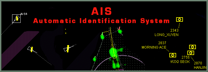
The AIS (Automatic Identification System) is now a mandatory instrument on the navigation bridge of sea-going vessels. The system broadcasts the ship’s identity, GNSS position, heading, course, speed and a few other data relevant for collision avoidance and traffic management. Other ships in the vincinity and shore-based services can receive the transmissions and use them in addition to the information made available by the conventional sensors, such as radar. AIS positions of the ships in the vicinity are displayed by means of a standardized symbol in the AIS set's display, in the ship's radar or in the ECDIS display.
It is generally of interest how many ship transmissions can be received by one AIS ship set or shore station. The number is limited by the AIS system bandwidth and depends on the message length and transmission sequence of the transmitting ships. As the latter data differ on the actual movements of the ships, the author has developed a simple calculator, with which an assessment of the number of ships that can be received by a single AIS set can be made. The results may not only be of interest for educational purpose of seafarers, but also for the planning of AIS shore stations.
Link to the AIS CapCalc Calculator
Ingo Harre, Bremen, Germany, Content last modified on 2009/04/25